Urbanizing coastal areas facing environmental challenges: The case of Timor-Leste
This text is a translation of an article originally written in French, published in March 2021 on the Géoconfluences website and updated in April 2021: Aménager les zones côtières à la hauteur des risques et des enjeux environnementaux : le cas du Timor oriental". This version in English has been co-published on the website La Clé des Langues.
Translation by the author, reviewed and corrected by Vanessa Guignery (Professor at ENS de Lyon) and Marion Coste (editor of the Clé des langues website)
This article is based on the research programme "Coastal areas governance in the context of a rapid tourism urbanization and climate change in Southeast Asia" (RFCC, 2016-2019) Funded mainly by the Regional Forum on Climate Change - RFCC (FR-EU-ASE), it was led by Christine Cabasset (IRASEC), Vilas Nitivattananon (AIT Thailand), Agung S. Wiranatha (Udayana Bali University, Indonesia), with the collaboration of the National University of Timor LoroSa'e. carried out through nine case studies in three countries - Indonesia, Thailand and Timor-Leste. The research arose from the observation that coastal tourist areas in the region were suffering from severe environmental degradation. The piles of waste - often plastic - on the beaches or in the sea, the discharge of waste water into the sea, or the risks induced by coastal erosion in highly urbanised areas are some of the most obvious signs of this degradation. Photos and videos of these examples are regularly posted by tourists on social networks (Cabasset, 2019). Our initial hypothesis, based on extensive field observations, attributed this situation mainly to the permanent discrepancy between the pace of tourism development (growth of international arrivals and hotel and real estate programmes) and that of the provision of urban and environmental services (Cabasset, Nittivatananon, Wiranata, 2019).
Box 1. Fieldwork as part of a research programme
This study was conducted through a total of nine case studies in the three countries. Although the degradation of coastal tourist areas was commonly observable even by non-specialists (especially before the global health crisis linked to Covid-19), the objective of the research was to verify this degradation using the scientific methods proper to the human and social sciences. The first objective was to better document the ways in which urban policies are decided and implemented and how the effects of climate change and, more broadly, environmental challenges, are taken into account. Another objective of this programme was to identify the main mechanisms and difficulties that explained the observed fragilities, but also the factors that play a role in improving urban and environmental management. The selected indicators included a critical analysis of development plans and national and local laws and regulations; the research focused in particular on climate change (effects and responses) and on solid and liquid waste collection and treatment systems. The research in Timor-Leste was based on multiple observations The author of this article has good knowledge of Southeast Asia, particularly Indonesia and Timor-Leste, having conducted field research there at least annually since the early 1990s and early 2000s respectively. An advisor to the East Timorese Ministry of Education (higher education programmes), then involved in the RFCC programme, and on assignment for UNDP in Oecussi, she resided in the country from 2012 to early 2018., literature review and targeted surveys on the environment and coastal urbanization. About 50 interviews were conducted, particularly with the public sector (general and national directors of the sectors in question), but also with bi- and multilateral agencies (such as ADB, JICA, UN-UNDP) and NGOs involved in these sectors, as well as with the main international standard hotels, all located in Dili.
Unlike in Thailand and Indonesia, where tourism activity developed between 1950 and 1970 and is characterised by a significant number of major tourist resorts, in Timor-Leste, the number of international tourists is still limited. The country's official independence only dates back to 2002, and it has no tourist hubs other than Dili, the national capital. Despite these differences, we felt it would be interesting to include the country in the regional study for comparative purposes. This case study analyses the orientations and governance methods used to conciliate tourism development and environmental preservation in the context of an emerging economy. Could Timor-Leste, a "young" country, have become a laboratory for sustainable development? Despite notable initiatives, the observations and conclusions of this study show significant weaknesses in these areas, in addition to revealing a lack of environmental risk culture, linked to deficiencies in the education sector. Many of these findings are nevertheless common to other South-East Asian coastal resorts or cities, often to a much greater extent given the scale of their population densities and tourist flows (Cabasset, Couteau, Picard, 2017; Peyronnie, Goldblum, Sisoulath, 2017; Sheng and Thuzar, 2012). In all three countries, however, the way local governance Understood as both the relationship between central and local governments, planning agencies, and other institutions, the delimitation of the perimeter of responsibilities, as well as the inclusion or not of key stakeholders.)) is expressed in a given space has emerged as a key factor, as the urbanism methods and the relation to the environment may differ greatly from one place to another.
1. The important stakes and challenges of national development
With a total area of nearly 15,000 km2 and a population of approximately 1.3 million, Timor-Leste shares the island of Timor with West Timor, which is part of Indonesia. Formerly a Portuguese colony (from the 16th century to 1975) and subsequently an Indonesian colony (1975-1999), the country gained its official independence on 20 May 2002. Since then, it has faced multiple challenges in national development. Despite significant progress in the social sphere with the introduction of free and universal basic education, free access to public health facilities, as well as a pension and social security system, 30.3% of the total population (in 2011) lives below the international poverty line (41.8% if the national poverty line is considered). Ever since independence, tourism has been identified as one of the priority areas for development. However, the country's late arrival on the international tourism scene, particularly in comparison with most other South-East Asian countries, combined with the poor efforts devoted to this sector, explains a certain "delay" in tourist flows and infrastructure. The national capital, Dili (276,000 inhabitants in the municipality according to the 2015 census, 230,000 to 250,000 inhabitants in the urban area), by far the main centre – urban, political, economic, commercial, academic, tourist, etc.–, plays a major role in national development. By contrast, the rest of the country is predominantly rural, with the vast majority of the population living off agriculture – often subsistence and livestock farming – and small coastal fishery.
Box 2. An emerging economy in which tourism is still marginal
Oil and gas resources continue to provide the necessary means for development, but their strong domination of the national budget (regularly 80 to 90%) is a weak point, all the more so in a period of decline both in production and barrel price. This situation makes it urgent to initiate economic diversification. In this context, together with the implementation of a strong social policy (in the domains of health, education, retirement, and the support of vulnerable people), economic development zones were created and tourism was designated very early on as one of the potential economic driving forces. However, since independence, the launch of tourist activity has been more a matter of rhetoric than of real will. The "delay" observed is not without interest, however, in the absence of a clear national tourism project. As many examples in the region show, large-scale tourism and real estate programmes, often developed without any major environmental or social requirements, have largely taken precedence over regulatory plans and tools over the last two or three decades (Cabasset, Couteau, Picard, 2017; Peyronnie, Goldblum, Sisoulath, 2017). The country is increasingly promoting the 'unspoilt' character of its cultural and natural environment.
The country saw more than 74,600 international arrivals at Dili airport in 2018 (nearly 200,000 if all arrivals by air, land and sea are combined), the majority of whom are residents and people on contract with the government or international agencies. The number of tourists - mostly from Australia, with Darwin only an hour's flight away - coming for leisure purposes or to visit relatives based in the country is estimated at 17,000 (2015-2016).
The three case study areas – Dili, the island of Atauro some 30 km off the coast of Dili, and Pante Makassar, the regional capital of Oecussi A legacy of colonial rule, Oecussi is an East Timorese enclave in West Timor, Indonesia. – have in common that they are all located on the northern coastline of the country. The three areas are designated, albeit at different levels, as economic development hubs: the Tibar-Dili-Hera segment was declared a National Strategic Area in the Timor-Leste Strategic Development Plan 2011-2030; Oecussi became a Special Administrative Region (RAEOA) and a Special Social Market Economy Zone (ZEESM) in 2014; Atauro Island, administratively a sub-district of the municipality of Dili In 2021, the island of Atauro could obtain the status of municipality to support its development., is also associated with the ZEESM for its development.
Document 1: Administrative map, main transport infrastructures and location of the three study sites
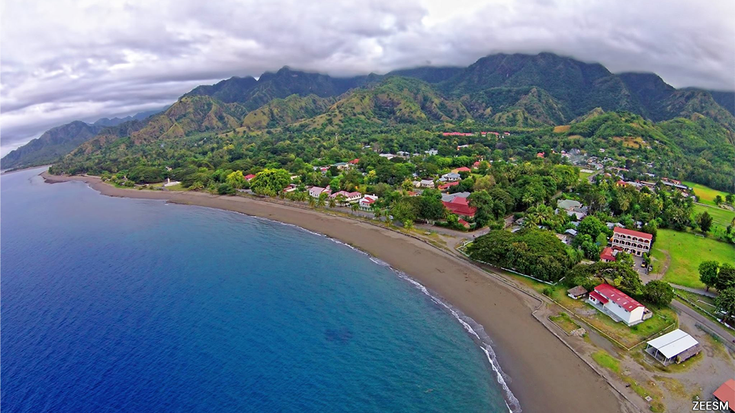
In Dili For further analysis of the demographic, spatial and planning dynamics of the country and Dili, see Cabasset, 2014., many official buildings have been built since 2002, as well as supermarkets and shopping areas, business centres, apartment blocks and residential developments; other constructions (commercial harbour, large hotels and shopping complexes) are underway or planned. The city has about 20 international standard hotels with 20 to 100 rooms, only some of which are located on the waterfront. This contrasts with the presence of seven or eight embassies on large plots of land, which is unusual due to the high land value of the coastline. The urban area of Dili expanded at the end of the Portuguese period, and then intensified during the Indonesian period and since independence. Today, there are plans to densify the entire coastal area of the Tibar-Dili-Hera strategic zone.
Document 2. The economic development hub of Dili (Tibar-Dili-Hera)
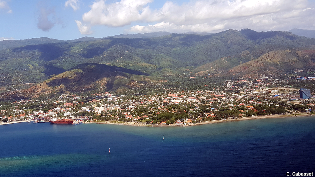
Document 3. Dili and the coast from the air
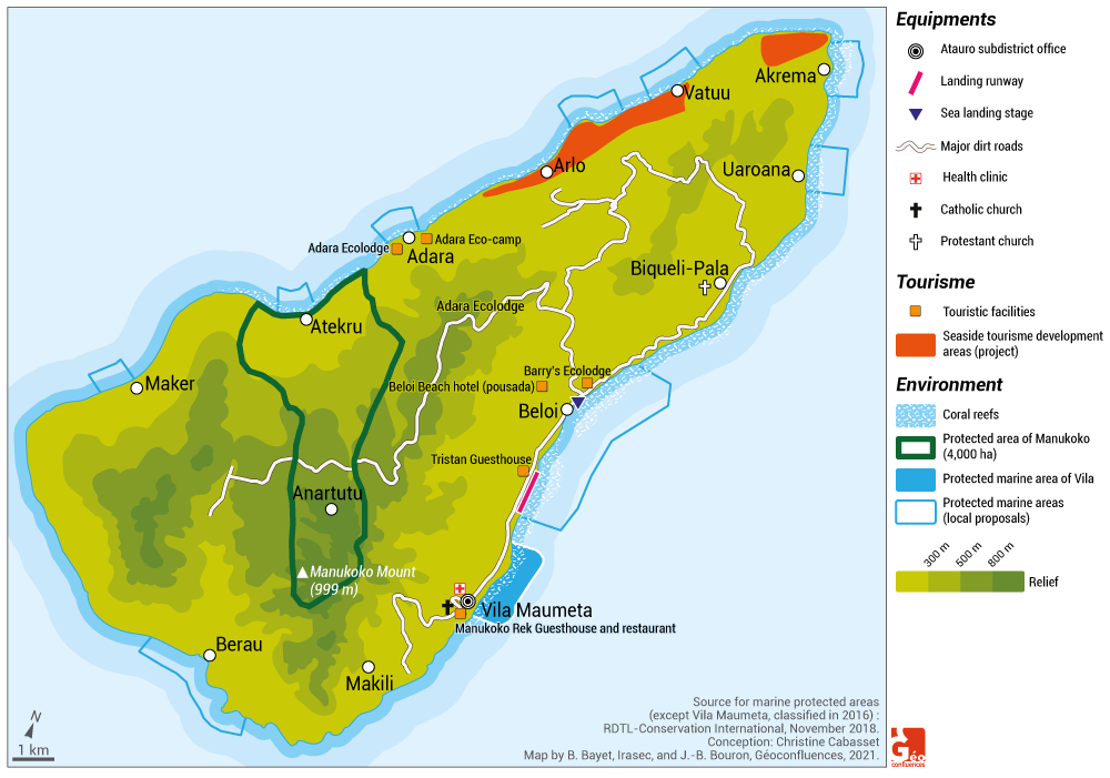
Document 4. Atauro Island, between protection and tourism development
Atauro Island is renowned for its local fishing activity, including underwater fishing. Mountainous, very lightly urbanised, with beautiful beaches and numerous diving sites, and accessible by boat from Dili in 1 to 3 hours, the island is a favourite destination for Dili residents and tourists. The hotel sector consists mainly of "local" architecture, with ecolodges (accommodation that puts ecology at the centre of their activity) and guesthouses, allowing a maximum capacity of about 40 people, plus a few campsites. The coastline has been the target of land speculation for several years. The tourism development plan commissioned by the ZEESM authorities in 2015-2017 considered the development of beach tourism in two main locations – which currently lack tourism infrastructure - in the north and north-west of the island, while local or community tourism was to be developed in other locations that already had experience in this field. However, little has changed since then, except for the extension of the coastal road from Beloi to Bikeli and beyond (for which construction is underway), and the island remains severely lacking in services (electricity, water and sanitation, transport, internet, etc.).
|
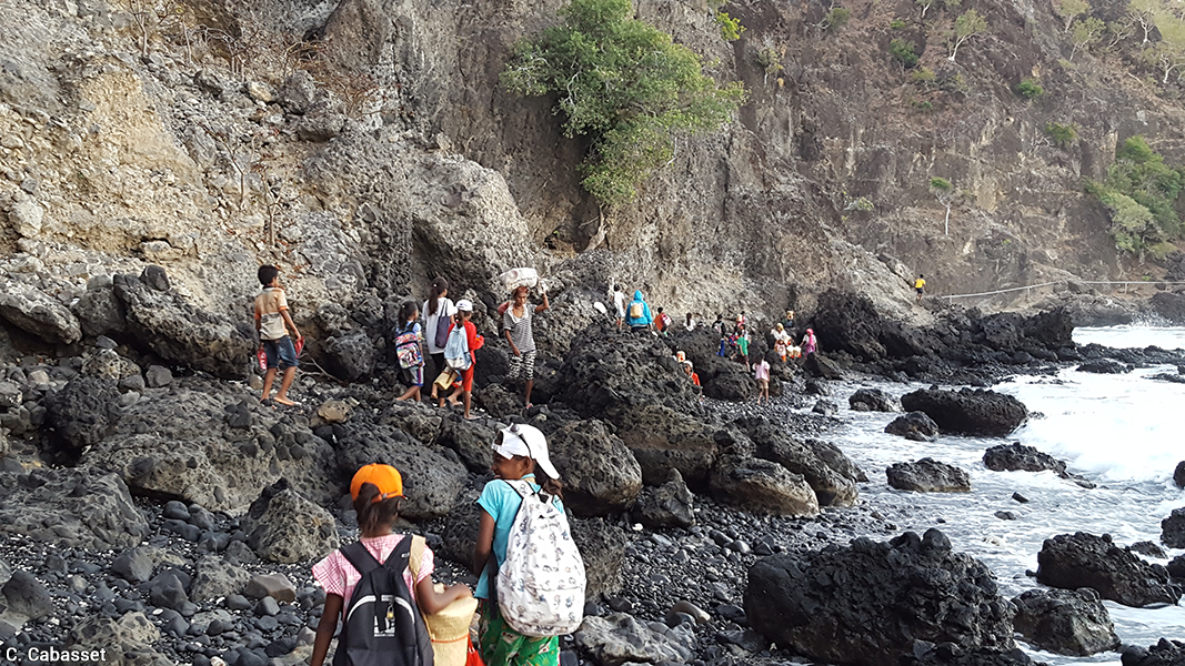
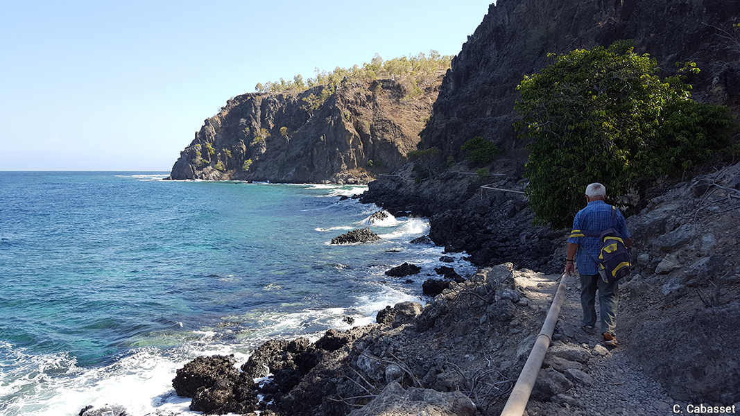
Document 5. At low tide, the coast remains the preferred route from Vila to Makili for the inhabitants, as the steepness of the road makes it nearly unpracticable
|
Document 6. Water pipeline between Vila and Makili
|
|
Document 7. Coastal road between Beloi and Bikeli
|
Document 8. Barry Ecolodge
|
|
Photos: Christine Cabasset, 2017 (documents 6 and 7) and 2018 (documents 8 and 9).
|
|
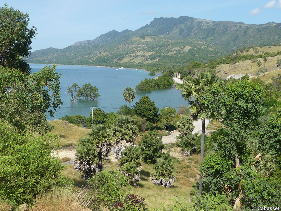
Although no less aesthetically pleasing (the arrival by boat or plane is quite spectacular), Oecussi attracts far fewer tourists due to its isolation, its distance from Dili, and poor tourist facilities. With the poverty rate in the region being well above the national average, the ZEESM aims to make it an attractive area, both in terms of population and investment, betting on its proximity to West Timor and Indonesia. Regional governance has proven to be effective, as shown by the infrastructure completed (or planned and underway) since 2015, particularly in the sub-district and especially in the "city" of Pante Makassar.
Document 9. Pante-Makassar locality, Oecussi: main features and infrastructure
|
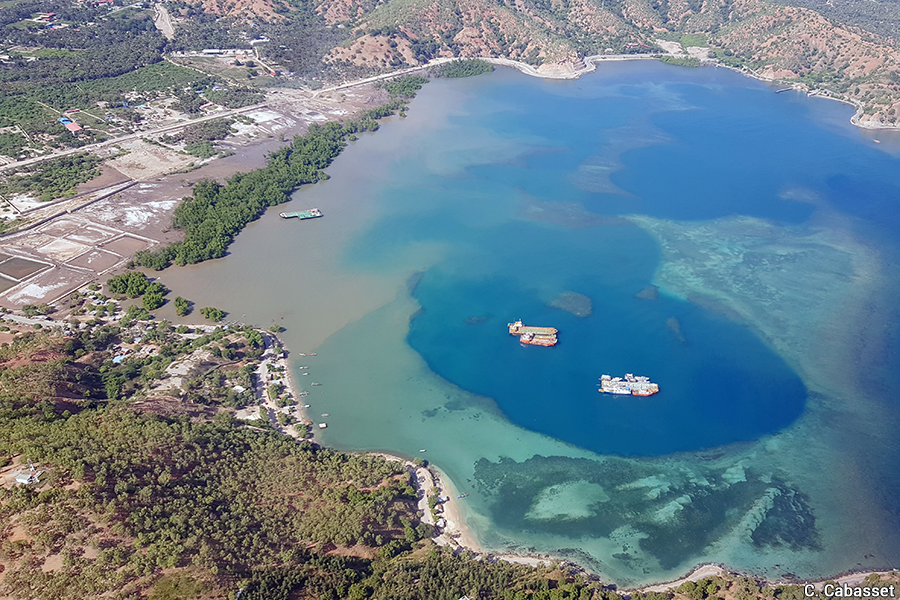
Document 10. Pante Makassar and its surroundings |
|
|
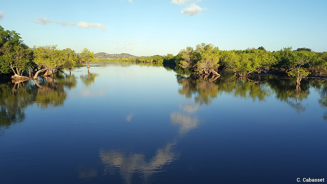
Mangroves of Pante Makassar (2018). Photo: Christine Cabasset.
|
|
|
Hand harvesting, a stone's throw from Pante Makassar city centre (2018). Photo: Christine Cabasset.
|
Noefefan Bridge over the Tono River (2018). Photo: Christine Cabasset.
|
2. An "unspoilt" country facing many environmental challenges
With very little industry and road traffic outside of Dili, Timor-Leste enjoys a natural environment, both on land and at sea, that is often described as "unspoilt". Nevertheless, the country, which has a 783 km long coastline including coral reefs and mangroves, faces many environmental challenges. These are related to climate change and hydro-meteorological events, but also to anthropogenic pressure, especially in Dili.
2.1. A country with a dry tropical climate vulnerable to hydrometeorological events and climate change
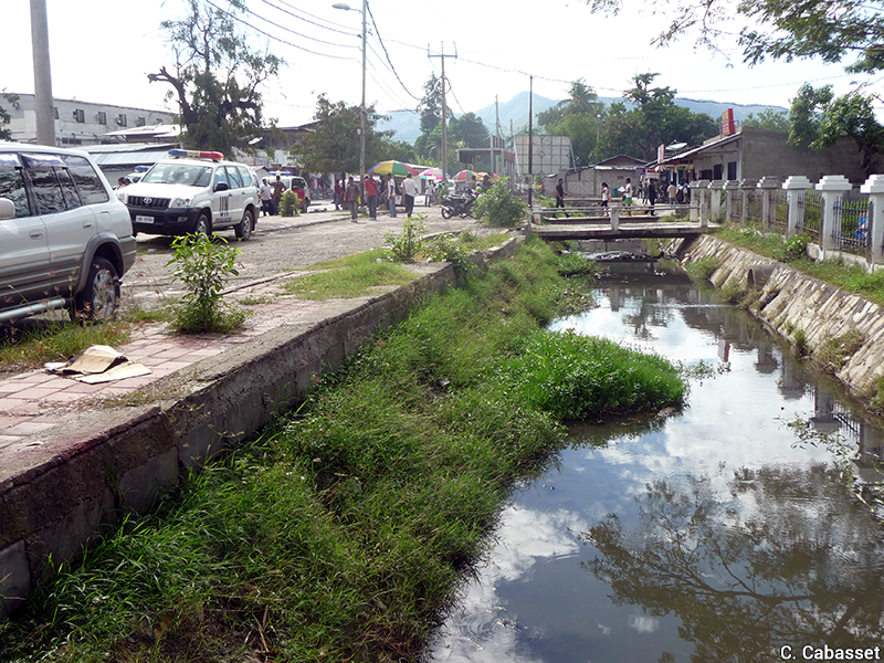
Although the country is, at present, not affected by tsunamis and volcanism, of which ancient traces are visible, it is still subject to seismic risk. Nevertheless, due to its geographical position in the intertropical region, its tropical dry climate and its monsoon season, the main hazards it faces are by far hydrometeorological in nature, with alternating droughts (and associated fires) and sudden, violent rainfall causing pluvial and fluvial flooding and landslides. These episodes are exacerbated by the recurrence of the El Niño / ENSO phenomenon, which also affects neighbouring countries and more widely the intertropical regions. In addition to these general climatic conditions, there is a very marked contrast between the mountainous areas, particularly in the centre of the country, where they can reach 3,000 metres and are marked by abundant rainfall, and the warmer and much drier coastal areas, particularly on the northern side (Durand, 2002). The three areas studied share the same climatic conditions: a long dry season (more than six or seven months) and no more than five months of rainfall, with, moreover, great variability from one year to the next. Their vulnerability is reinforced by the geophysical conditions – the narrow coastal plains, the proximity of mountainous terrains, and the important presence of rivers in Dili (to which must be added 36 drainage channels, cf. Santos Almeida et al., 2015) and in Pante Makassar - but also by the increasing urbanisation around Dili, the deforestation of the slopes and watersheds and the diminution of mangroves.
Document 11. Map of agro-climatic zones
The heavy rains brought by La Niña in July 2010 (a particularly dry month) led to the isolation of many villages. The long El Niño drought (2015-2017) affected around 200,000 people in the country. More recently, torrential rains on 13 March 2020 severely affected the coastal areas of Dili within two hours, partially or totally destroying the homes of 1,700 families, or 10,000 people. The torrential rains that fell between 29 March and 4 April 2021 on Timor-Leste (and East Indonesia), as well as the rain, river and marine flooding and landslides, resulted in some 40 deaths, a dozen people missing, at least 12,000 internally displaced people, and more than 4,500 destroyed or badly damaged houses. Some areas of the coastal plain of Dili and the banks of the main rivers (notably the Comoro), where the most vulnerable households are concentrated, were the most affected.
While the density of government and NGO services in Dili means that residents can be rescued relatively quickly, Timor-Leste's national warning and relief system is still far from functioning effectively in emergencies, particularly because of limited technological, human and coordination capacities, resulting in excessively long response times by the authorities (Sagar, Cook et al., 2018: 43). To address this weakness, a new law promoting the decentralisation of civil protection is currently being drafted. At the same time, the use of new technologies via digital applications and telephone messages (already used for the past ten years in the health sector in particular) is increasing. The fact remains that a culture of environmental risk (Bélizal, 2019; Pagney Bénito-Espinal, 2019) is often still lacking, a trait that should be emphasised in a context where the fight against the Indonesian occupation (1975-1999) has given the populations more of a political and social risk culture.
Timor-Leste's greenhouse gas (GHG) emissions are negligible in the global and regional context. But, like others in the same case, the country is highly vulnerable to various climate change effects such as coastal erosion and marine submersion (Bamber, Oppenheimer and al., 2019; Duvat, 2015; Oppenheimer and al., 2019), in addition to increased climate variability. These risk factors are known to be increasing. This is a point that the East Timorese regularly emphasise at major global meetings on climate change, such as the COP21 in Paris (2015), and that constitutes one of the areas of research that links the territory to the Pacific Island States. Nevertheless, the effects of climate change are visible on the ground and are being noted by local fishermen and farmers. The study conducted in Dili in 2015 by two East Timorese academics at two coastal sites, Hera and Coconut Beach (the embassy district in downtown Dili), highlighted various hazards related to sea-level rise, in particular submersion and coastline retreat (Barbosa and Gusmão, 2015).
Box 3. Climate change as an aggravating factor in coastal erosion
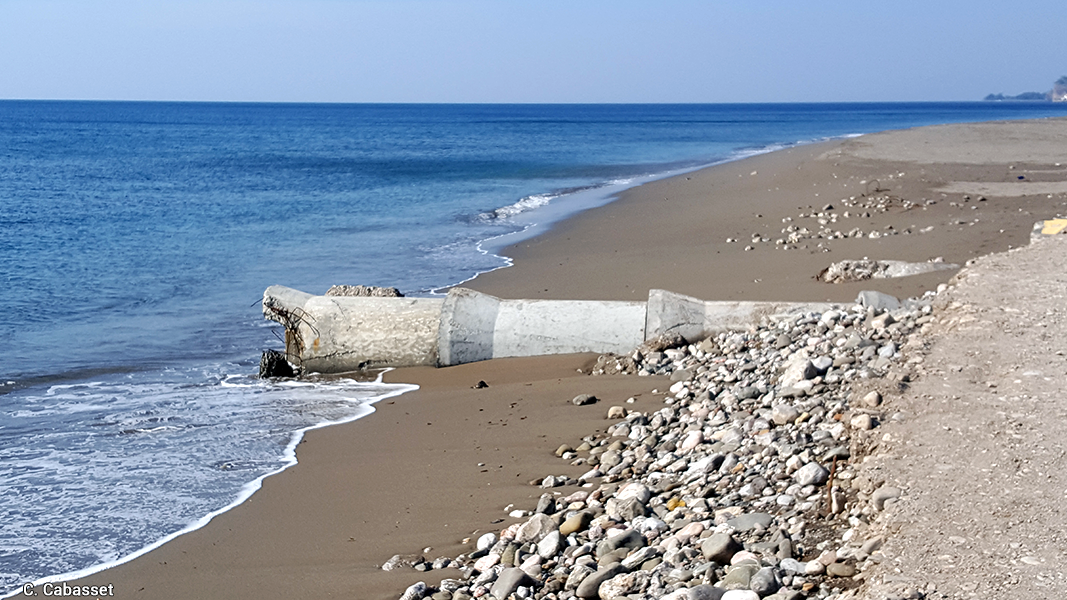
Climate change, through sea-level rise and ecosystem degradation, is a potential aggravating factor for coastal erosion in high islands where the natural functioning of the coast is disturbed by human activities. On these islands, the encroachment of human issues on the "natural" buffer zone (reef flats, dunes and barrier beaches, mangrove swamps) limits the possibilities of sedimentation (accumulation of sediments) which could compensate for the sediment losses due to erosive storms and the negative effects of human activities.
From Virginie Duvat, 2015 (p. 557-558).
|
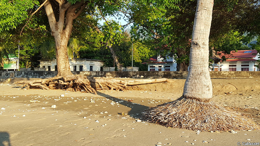
Document 12. Coastal erosion, Pante Makassar |
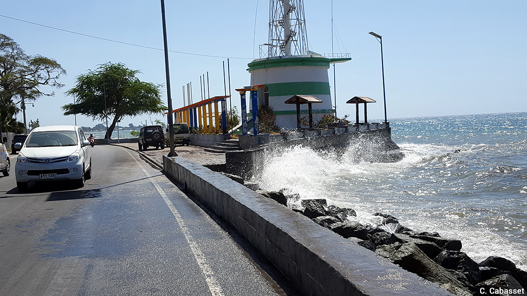
Document 13. Farol (lighthouse) area in Dili at high tide Photos 12 and 13: Christine Cabasset, 2018.
|
|
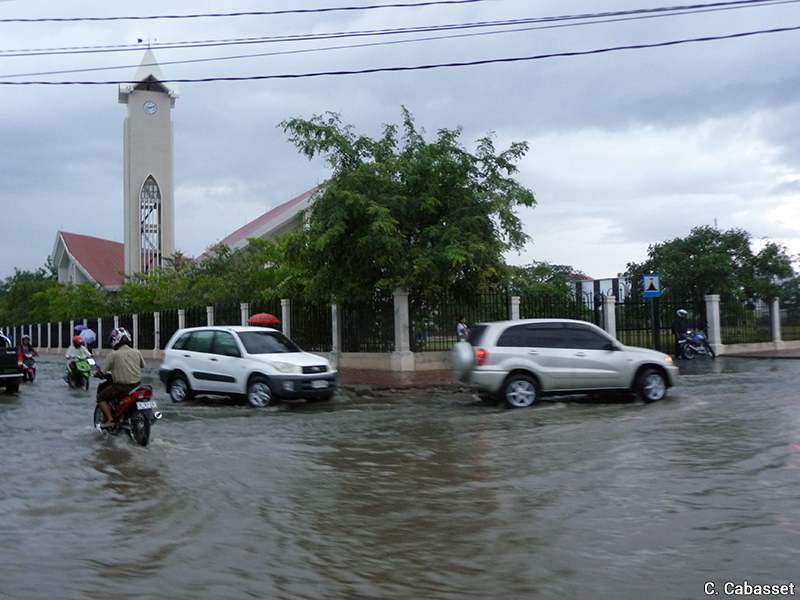
Document 14: Flooding due to saturation of drainage channels in Dili |
|
 |
Photos: Christine Cabasset, 2012 (left) et 2014 (right). |
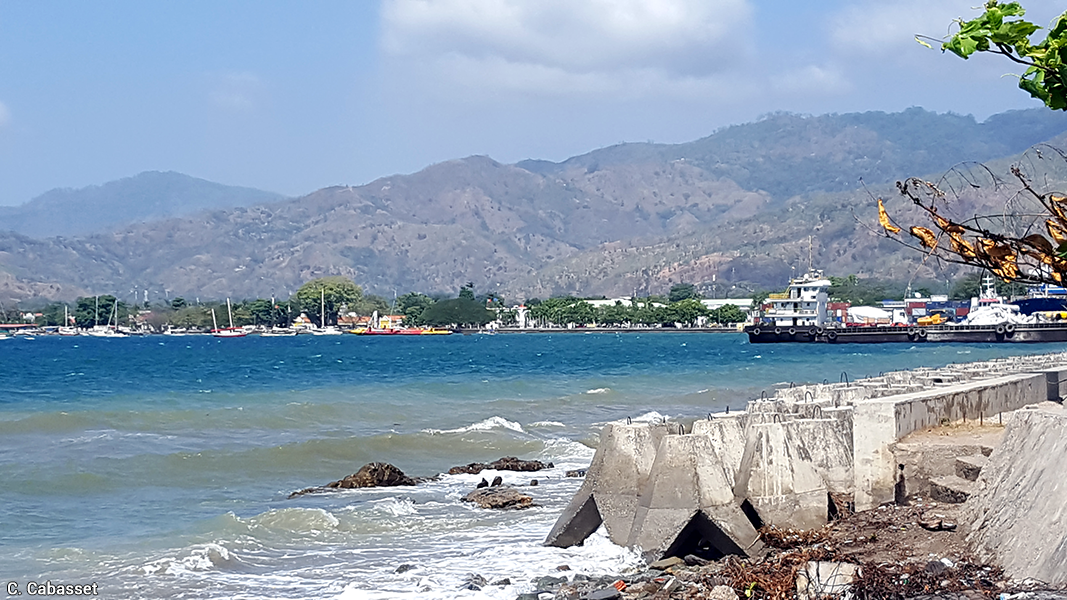
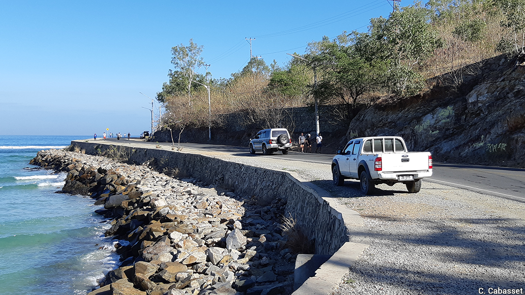
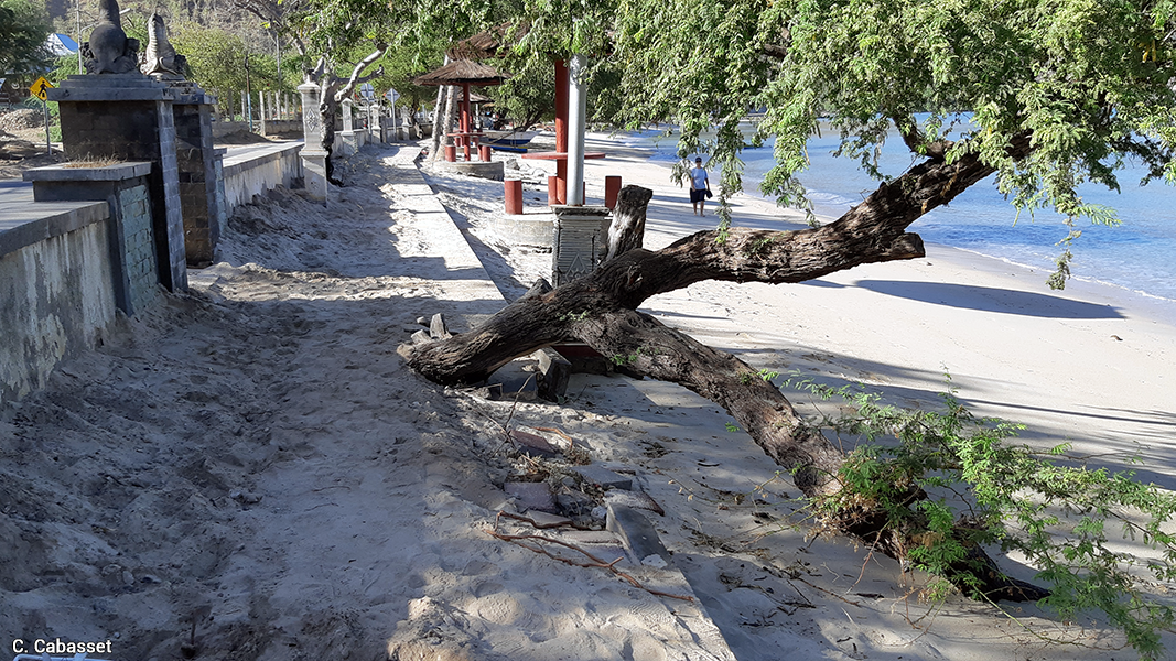
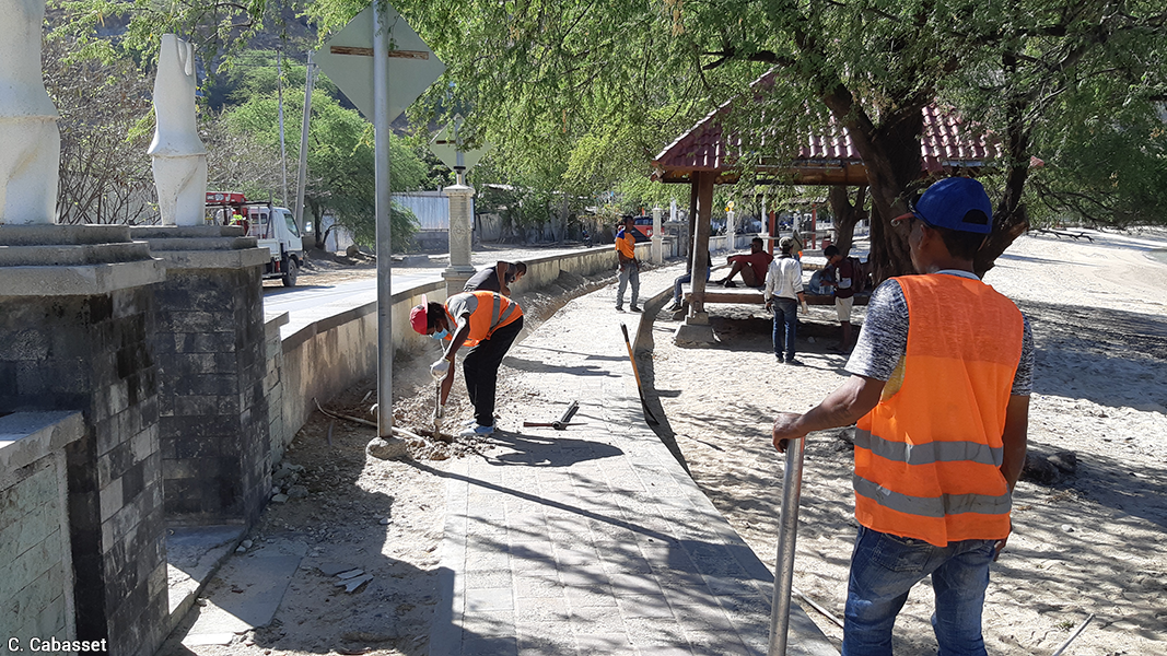
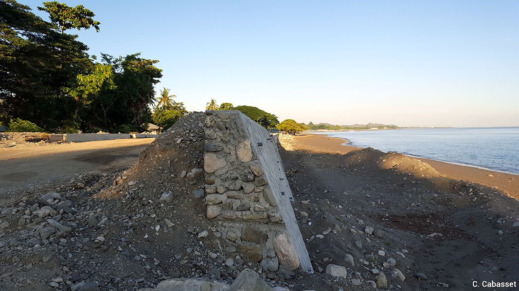
However, like many other regions in the world, the coastal fringes of Dili, Atauro and Pante Makassar concentrate human, economic and leisure activities. The objective of facilitating leisure activities and in particular non-motorised travel (walking and cycling) has led to the construction of promenades along Dili and Pante Makassar bays; these, however, encroach on the beach and are built using concrete. The coastal roads, often built in the late Portuguese colonial period (1960s-1970s), are now overhanging at high tide in several places due to coastal erosion and are regularly subject to marine flooding episodes. Surprisingly, roads or infrastructure have also been built or rebuilt recently in close proximity to the coastline. As a result, the government regularly has to intervene to restore them, just as it has had to build protective dikes to break the power of the waves, especially in Dili. Similar findings have been made in the main coastal tourist resorts of Indonesia and Thailand.
2.2 Anthropogenic pressures: the case of wastewater and solid waste management
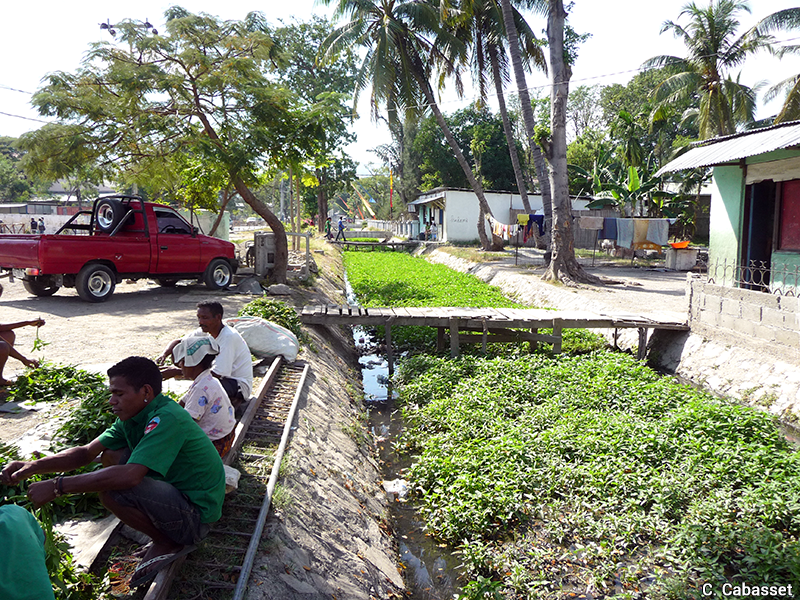
Wastewater treatment and the sanitation system are some of the black spots in urban management, leading to pollution of the sea, rivers, groundwater and soil, and the subsequent risks of contamination. After independence, the rehabilitation and improvement of Dili's drainage channels was an urgent task, as most of the network, which dated back to the Portuguese era, was very undersized compared to the city's demographic and spatial expansion. The lack of maintenance, but also the inhabitants' habit of throwing their waste into the canals or using some of them for Kankung (water spinach) plantations, contributed to the obstruction of the channels and the systematic occurrence of floods during the rainy season. Although much has been done since then to expand (in size and number of pipes and canals), clean the network and prohibit any non-drainage use, it will be a long-term effort to make the system effective.
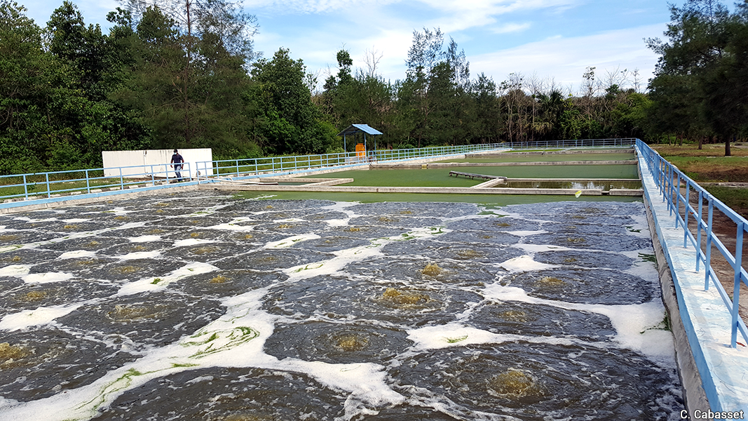
The lack of any sanitation network (sewers and treatment units) in the country is also problematic. To compensate for this, the central government and the municipality of Dili are in charge of collecting and transporting wastewater by tanker from septic tanks to the treatment plant in Tibar, located 10-15 km from the centre of Dili. The system is a second-best measure: only significant businesses - such as major hotels, apartment blocks or housing estates - equipped with septic tanks require the (paid) government service for pumping and transporting wastewater. A small proportion (estimated at 10% to 15%) of the total volume of wastewater is thought to be collected and treated. The government is working with Japanese cooperation (via the Japan International Cooperation Agency, JICA) on a sewerage project running from east to west through Dili, parallel to the coast. In view of the observations and interviews conducted on the same topic in southern Bali, it seems essential to consider the various technical options, to identify the priority objective (connection to the network or return on investment) and to discuss it with the various parties, including the users. Indeed, in Bali, although the sewerage network set up about ten years ago in the main tourist resorts is of prime importance, the network has overall failed: as connection is optional and users have to pay for it, cost is cited as the main reason for its rejection by most households, hotels and other tourist businesses.
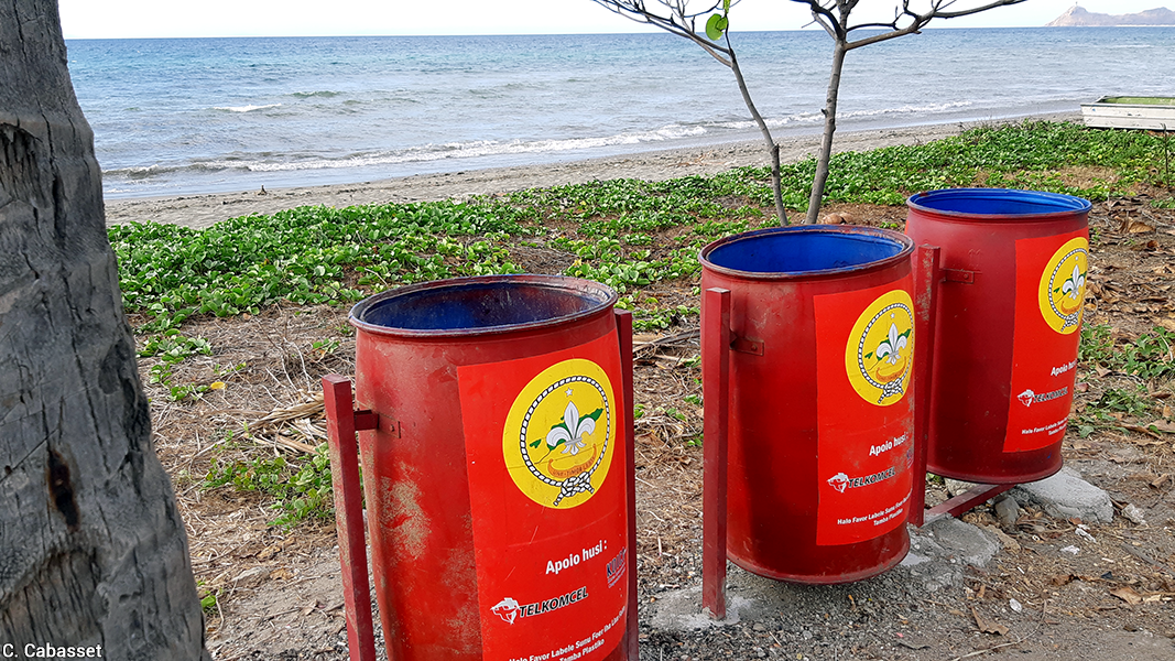
Solid waste collection and treatment is another urban management bottleneck. This sector was identified as the country's third-largest source of GHGs in Timor-Leste's Initial Communication on Climate Change in 2014. In Dili, as elsewhere in the country, on-site burning of household waste is still the general rule. However, unlike most places in the country, Dili has a municipal waste collection system, operated by the private sector. According to official statistics, about 70% of the waste is collected and transported by truck to the landfill in Tibar, which, like the sewage treatment plant, is located less than 2 km from the sea. Moreover, the system only covers the four most populated sub-districts, so there is still room for improvement, including in the city centre and on the beaches. Since 2016, various government resolutions and decree-laws on solid waste management (national and Dili) and marine litter have been important steps in raising awareness of the problem and implementing improvements. Also, since the beginning of 2019, restaurants and several supermarkets have stopped distributing food trays and plastic bags, favouring biodegradable products made of cardboard or cassava (produced in Bali).
Atauro has no sewage, wastewater or solid waste collection and treatment systems. Motivated by the preservation of the environmental quality of the island, which is located in the Coral Triangle The establishment of the Coral Triangle in 2009 was a multilateral initiative to protect the exceptional richness of marine biodiversity in a region of the Pacific Ocean. This includes the Philippines, East Indonesia, Timor-Leste, Papua New Guinea, the Solomon Islands and Sabah in northern island Malaysia. and is known for its rich marine biodiversity, positive initiatives in these sectors have nevertheless emerged. These are driven by the private sector, mainly tourist accommodations and inhabitants, and supported by local NGOs and their foreign partners: examples include beach cleaning, the creation of marine protected areas, coral monitoring, local solutions for wastewater and solid waste treatment, compost, recycling, etc. In the long term, however, more organised solutions seem essential.
In Pante Makassar, the situation has long been the same as in the rest of the country outside Dili. However, since 2015-2016 the Region has been contracting a private company to clean public spaces and beaches in the city centre; it has also planned the construction of wastewater and solid waste treatment units (still not built in 2018). In addition, all roads built or rehabilitated have been equipped with wide pavements over rainwater drainage pipes.
3. Governance faced with the dilemma between environmental protection and economic development
With the support of its international partners, Timor-Leste has been active in the areas central to our research: some 30 laws and regulations have been promulgated over the past 20 years at the national level, in addition to other legal provisions specifically concerning Dili, Atauro or Oecussi. In the field of protected areas, the national network has grown to a total of 46 in 2016, with more areas being created in Atauro. However, in these sectors as in others, the main problem lies in the communication, application and control - with adequate human, material and financial resources - of laws and regulations.
|
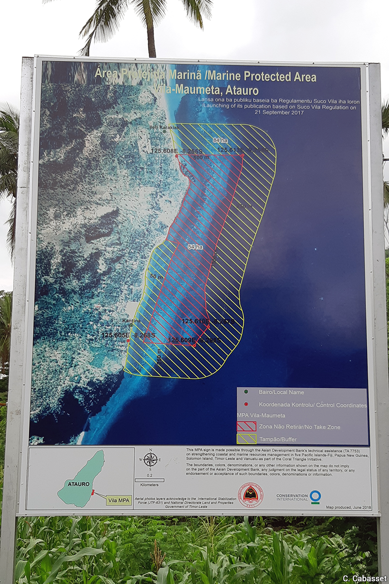
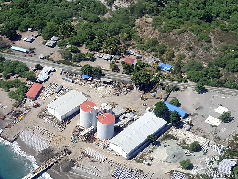
Document 20. Marine Protected Area and regulatory violations |
|
|
Information panel about the Vila-Maumeta (Atauro) marine protected area (2019).
|
Recent constructions in the non aedificandi zone: Restaurant in Metiaut, Dili (2014, top) and cement factory 50 km west of Dili (2018, bottom).
Photos: Christine Cabasset. |
The absence or low number of spatial plannings seems to us to be characteristic of the difficulties encountered locally. At the national level, the only document that serves as a planning tool, which has been followed by successive governments since its publication, is the Timor-Leste Strategic Development Plan 2011-2030. It was presented and discussed in all sub-districts of the country in 2010. Reflecting the multiple priorities of the time, it gives the main geographical and sectoral orientations in terms of institutional, economic and human development. However, it does not constitute a "Plan". Above all, for operational purposes, all municipalities are expected to have a territory planning. But the two trials carried out by the Portuguese agency Gertil in Dili in 2006, and then by the Japanese agency JICA in the Tibar-Dili-Hera area in 2016, have not been updated. In fact, despite the existence of a municipal administration (whose jurisdictions, officially acquired in 2016, are admittedly recent), Dili, like other capitals in the world, suffers from the overlap of responsibilities between the national and municipal levels. Faced with this, the Oecussi Region has clearly distinguished itself by the accomplishment, in a few years' time, of a Land and Development Plan and of significant infrastructures: it is also the only Region to have been endowed with a development budget of 500 million US $ (to date). These financial means, as much as its status as a Special Region, worked in favour of the elaboration of a regional governance.
Box 4. The challenges of the education sector and the shortcomings of geography and planning training
The education sector, which remains one of the country's main challenges, does not succeed in training the population to meet the challenges that the country must face. This must be seen in a historical perspective since, just like the health sector, its state of disrepair in 1999 was due to both physical destruction and a lack of local human resources: a large proportion of the staff, who until then had been Indonesian, had left the country. In the longer term, the weakness of the education system is inherited from a Portuguese period when education, mainly provided by Catholic schools, was rigorous but only accessible to a small elite. The Indonesian period that followed was marked by an unquestionable increase in schooling; however, the motivations of control and Indonesianisation of societies explain the fragmentary nature of the education system. History and geography, considered too political, were not taught, and when they were, they only dealt with the colonising country, as is often the case elsewhere in the world. It is no coincidence therefore that before 1999 the leaders of the independence resistance, aware of that handicap, imagined that they would benefit from a transitional period of ten or fifteen years (the time needed to get good human resources) under the authority of the United Nations before full independence. The UN transitional administration finally lasted only two and a half years (September 1999 - May 2002). Even today, with the exception of occasional initiatives, none of the country's 17 universities or higher education institutes has a geography department or offers specific training in planning. Any teaching in this field, the environment and climate change, is mainly done by the faculties of agriculture and engineering (including architecture). Moreover, lifelong training, which is fundamental to train political leaders and civil servants in these issues, remains insufficient, although it is being done in cooperation with other countries. Finally, as was regularly suggested during our interviews, better training for journalists and media coverage of the topics central to our research would make up for the lack of information and general culture in these areas.
Regardless of location, although (or because) it is coveted, the coast has not yet received special attention: it is symptomatic that during our research (2016-2019), none of the many ongoing international aid programmes targeted coastal areas, with the exception of mangrove restoration (UNDP) outside urban areas. The government may have encouraged its partners to prioritise support for agriculture and rural and mountain populations, which is certainly crucial, but at the same time it was reluctant to consider programmes that could have paved the way to future constraints for the investments that it is calling for. As a result, although the challenges and risks of climate change are clearly stated in national documents, the legally declared non aedificandi coastal strip is only 50 metres, while building standards (location, architecture, materials, height) are still non-existent. On the other hand, Bali, which is an hour and a half away by plane, is emblematic of an island where, since the 1970s, the non aedificandi zone has been (when respected) 100 metres from the high tide line and the maximum height of buildings is fixed at the size of a coconut tree, i.e. 15 metres (which is original in the Indonesian and South-East Asian context). Large-scale projects in Timor-Leste have been subject to an environmental licence since 2011, which can be obtained only after an environmental impact assessment has taken place and an environmental management plan has been established. However, many of these projects, both public and private, are initiated or carried out without an environmental licence, due to a lack of knowledge of environmental issues or the intervention of political networks and corruption. Moreover, as in many other Southeast Asian countries, political decisions often reveal the dissociation between "economic development" and the "environment", while the link between "risks" and "spatial planning" is still not very clear. With the arrival in government of ministers and staff trained in these issues, however, significant measures have been taken in the field of the 'environment' (Cabasset, 2020).
Conclusion
Over the past two decades, Timor-Leste has made spectacular progress in many areas, such as security and socio-economic development, and is one of few democracies in Southeast Asia. This progress, but also the weaknesses noted in this article in the planning and environmental sectors, need to be understood in the light of the considerable work the state has had to undertake since 1999 and 2002 (see epilogue). While the historical legacy continues to weigh on the population, infrastructures and services today, recent independence means that spatial planning concerns are still new (Cabasset, 2014). The feeling of being overwhelmed expressed by officials encountered for this research, born out of the large number of priorities since 2002, may also be fuelled by a lack of political will, funding, coordination and quality training (at all levels). However, the country can take credit for the presence of active NGOs, local dynamics in the field of agriculture (permaculture, organic farming) and the reactivation of local knowledge (Tara Bandu While most local ceremonies and rituals were banned between 1975 and 1999, various traditional practices were revived in the early 2000s. These include the Tara Bandu, a ritual based on the balance between humans and nature, which involves community customary rights and duties according to what was taken from nature, both on land and in the sea. See Amaral de Carvalho and Coreia, 2011.) in the preservation of natural resources and social cohesion, as well as a growing interest in environmental issues. However, one of the interests of this study was to show, in Timor-Leste as well as in the other countries under study (Indonesia and Thailand), how coastal areas, especially when they are urbanised, often remain a blind spot in land use planning, which is constrained by climate change, due to a lack of knowledge of the environment and the priority given to economic issues. Thus, for external observers and local environmental NGOs alike, this "new" country did not become a laboratory of good practices in "sustainable development": it rather illustrates a missed opportunity.
Epilogue. Could the opportunity to be a model of sustainable development not have been "missed"?
Making the country a laboratory for sustainable development would have required it to free itself, especially in the early years, from the Indonesian governance and planning 'model', the worst aspects of which it had experienced during the occupation. Moreover, in the wider South-East Asian context, environmental and social issues are still often insufficiently taken into account. Concerning the historical framework and without going into detail about the pre-colonial and colonial periods (see Araujo Corte-Real, Cabasset and Durand, 2014), we may limit ourselves to taking up the observation made by Bertrand Badie (2018) according to which colonisations (Portuguese and Indonesian in the case of Timor-Leste) have been as unsuccessful as decolonisations. This is notwithstanding the attachment of a large section of the population to the Portuguese cultural legacy and the familiarity (of familial, linguistic, educational nature, etc.) with the former adversary, Indonesia, which, after independence, was to play in favour of the normalisation of relations and the development of cooperation between the two countries. The fact is that in 1999, East Timor entered globalisation full steam ahead, with the UN-supervised landslide vote in favour of independence (78.5%, on 30 August 1999), followed by the United Nations transitional administration mission, and then, at a much higher level, by the official declaration of independence on 20 May 2002. For the first time in its history, Timor-Leste entered the Concert of Nations. On the ground, however, the country faced many difficulties and structural challenges, since it had to simultaneously build state bodies (government, parliament, presidency, courts, etc.) and rebuild physical infrastructure (80% of which had been destroyed in September 1999). The difficulties were also economic in nature because, pending the signing of new oil agreements with Australia (2002) and the creation of a national petroleum fund (2005), the country was reliant on international aid. Another major challenge was the increased complexity of Nation-building while taking into account the presence and action of thousands of foreigners from different geographical, cultural, linguistic and educational backgrounds. This is not to say that the East Timorese were resourceless at the end of the conflict: the daily and long-term strategies of survival and resistance to the occupation, deployed at the individual and collective levels, provided them with undeniable intellectual tools and capacities, in addition to a freedom of speech that often contrasts with the tone of regional diplomacy. The war had not, however, equipped them with the mechanisms necessary for the modern state and international aid programmes or, indeed, for the fight against climate change.
Notes
Bibliography
- Amaral de Carvalho Demetrio and Coreia Jose, 2011, "Tara bandu nudar: Matenek ekologia tradisional" [About Tara Bandu: traditional ecological knowledge], in Amaral de Carvalho (ed.), Matenek Lokal Timor Nian [Local knowledge of the East Timorese], UNESCO, Dili, p. 52-67.
- Badie Bertrand, 2018, Quand le Sud réinvente le monde. Essai sur la puissance de la faiblesse [When the South reinvents the world. An essay on the strength of weakness], La Découverte, Paris.
- Bamber L. Jonathan, Oppenheimer Michael and al., 2019. « Ice sheet contributions to future sea-level rise from structured expert judgment ». Proceedings of the National Academy of Sciences-PNAS [online]
- Barbosa Soares Adão, Gusmão Marçal, 2015. Climate change impacts and vulnerability assessment report for Hera and Pantai Kelapa, Center for Climate Change and Biodiversity (CCCB), Faculty of Agriculture, National University Timor Lorosae, Dili, 83 p.
- Bélizal Édouard de, 2019. « Le volcan Merapi (Indonésie) : espaces et temporalités du risque sur un volcan indonésien singulier » [The Merapi volcano (Indonesia): spaces and temporalities of risk at a unique Indonesian volcano], Géoconfluences, September 2019.
- Cabasset Christine, 2020. « Timor-Leste. Petit, lointain... et aux cœurs de préoccupations stratégiques » [East-Timor. Small, far...and at the heart of strategic concerns], in Cabasset Christine and Tran Claire Thi-Liên (eds.). L'Asie du Sud-Est 2020. Bilan, enjeux et perspectives [South-East Asia 2020. Overview, issues and perspectives]. IRASEC-Les Indes savantes, p. 375-399 (and yearly editions since 2010).
- Cabasset Christine, 2019. « Tourisme littoral et risques environnementaux » [Coastal tourism and environmental risks], in Pierdet Céline and Sarraute Éric (eds.), L'Asie du Sud-Est. Une géographie régionale [South-East Asia. A regional geography]. Ellipses, p. 465-480.
- Cabasset Christine, Nitivattananon Vilas, Wiranatha S. Agung, 2019. Final Report on Coastal areas governance in a context of rapid tourism urbanization and climate change in Southeast Asia (project for the Regional Forum on Climate Change-RFCC 2016-2019) (np).
- Cabasset Christine, Couteau Jean, Picard Michel, 2017. « La poldérisation de la baie de Benoa à Bali : vers un nouveau puputan ? » [The reclaiming of the Benoa bay in Bali: towards a new puputan?]. Journal Archipel 93, p. 151-197.
- Cabasset Christine, 2014. « L'aménagement du territoire au Timor-Leste : un enjeu récent entre héritage historique et internationalisation contemporaine » [Land planning in East-Timor: a recent challenge between historical heritage and contemporary internationalisation], in Corte Real de A. Benjamim, Cabasset Christine, Durand Frédéric (eds.), Timor-Leste contemporain. L'émergence d'une nation [Contemporary East-Timor. The advent of a nation], IRASEC-Les Indes Savantes, Bangkok-Paris, p. 279-308.
- Chandara Sagar Vishalini, Cook Alistair D. B., Nair Tamara, Ne Foo Yen, 2018. Integrating a Disaster Response Architecture in Timor-Leste: Opportunities and Challenges, NTS Report No. 8, S. Rajaratnam School of International Studies, Singapour, 46 p.
- Durand Frédéric, 2002. Timor Lorosea'e, pays au carrefour de l'Asie et du Pacifique, un atlas géohistorique [Timor Lorosea'e, a country at the crossroads between Asia and the Pacific, a geohistorical atlas], Presses universitaires de Marne-la-vallée-IRASEC, Marne-la-Vallée-Bangkok, 208 p.
- Duvat Virginie, 2015. « Changement climatique et risques côtiers dans les îles tropicales » [Climate change and coastal risks on tropical islands], Annales de géographie 2015/5, n° 705, Armand Colin, p. 541-566.
- Oppenheimer Michael, Glavovic Bruce and al., 2019. "Sea Level Rise and Implications for Low-Lying Islands, Coasts and Communities". In: IPCC Special Report on the Ocean and Cryosphere in a Changing Climate [Pörtner Hans-Otto, Roberts D.C., Masson-Delmotte Valérie et al. (eds.)], p. 321-445.
- Pagney Bénito-Espinal Françoise, 2019. « Construire une culture du risque efficiente ? Le cas de la Guadeloupe et de la Martinique » [Building an efficient culture of risk? The cases of Guadeloupe and Martinique], Géoconfluences, December 2019.
- Peyronnie Karine, Goldblum Charles, Sisoulath Bounleuam (eds.), Transitions urbaines en Asie du Sud-Est. De la métropolisation émergente et de ses formes dérivées [Urban transitions in South-East Asia. Emerging metropolisation and its derivates], IRD / IRASEC, Marseille, 2017.
- RDTL-State Secretariat for Environment, 2014. Timor Leste's Initial National Communication Under United Nations Framework Convention on Climate Change, Dili, 182 p.
- RDTL-State Secretariat for Environment, 2010. Timor-Leste National Adaptation Programme of Action (NAPA) to Climate Change, Dili, 108 p.
- Santos Almeida Octavio R., Piedade Brás João, Da Cruz Gustavo, 2015. "The Geography of Dili and the Flood Control Problems", Second Makassar International Conference on Civil Engineering, 11-12 August, Makassar, Indonesia.
- Sheng Yap Kioe, Thuzar Moe (dir.), 2012. Urbanization in Southeast Asia. Issues and impacts. ISEAS, Singapore, 387 p.
Pour citer cette ressource :
Christine Cabasset, Urbanizing coastal areas facing environmental challenges: The case of Timor-Leste, La Clé des Langues [en ligne], Lyon, ENS de LYON/DGESCO (ISSN 2107-7029), décembre 2021. Consulté le 15/02/2026. URL: https://cle.ens-lyon.fr/anglais/se-former/dnl/dnl-geographie/urbanizing-coastal-areas-the-case-of-timor-leste


